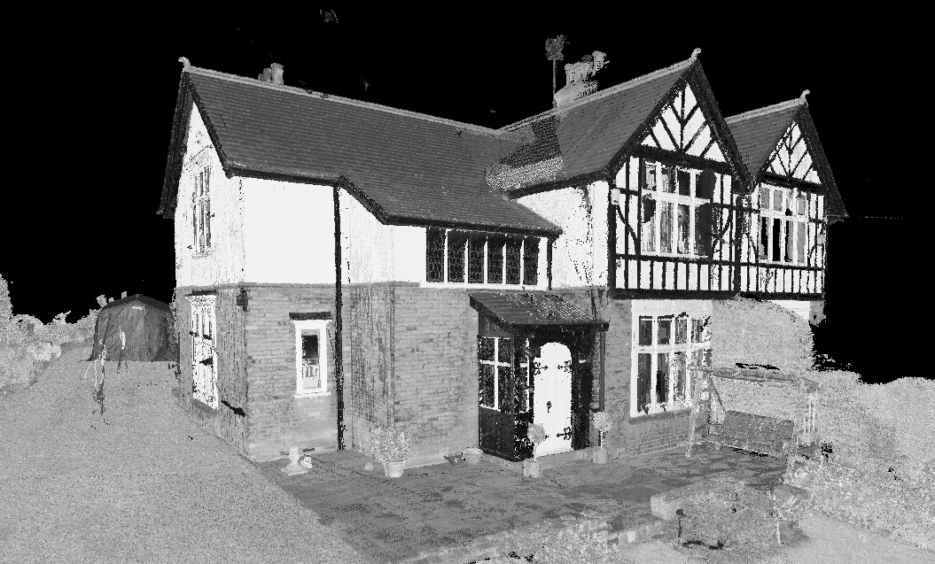
First Point Surveys use the latest in Laser Scanning technology to capture 3D point cloud data on site. The data will usually be related to the Ordnance Survey Grid using GPS (correctly known as GNSS). This cloud is then used to create AutoCAD drawings or made available as a deliverable itself.
Laser Scanning allows for on site data capture in the most efficient manner, capturing all visible features from accessible areas to very precise tolerances.
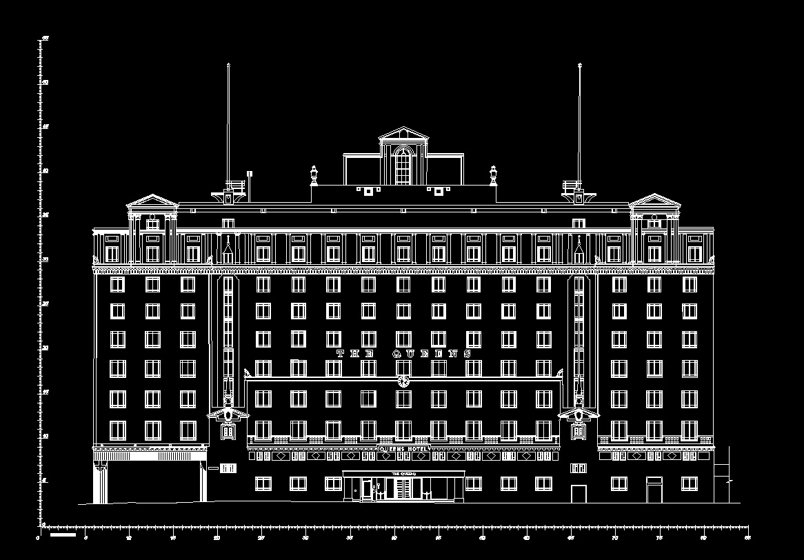
The CAD drawings we create from the cloud include the following: -
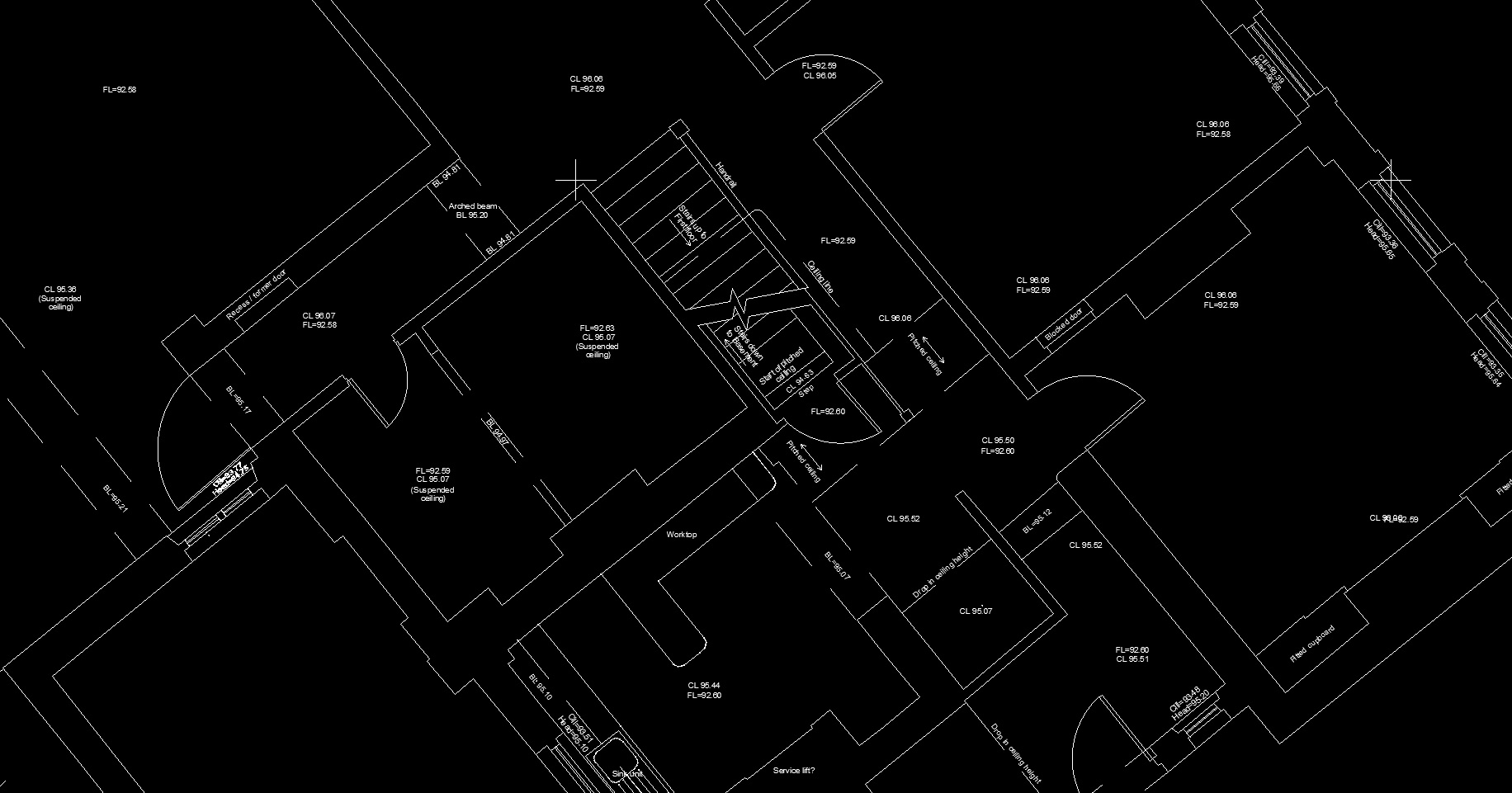
- Floor plans - showing working space, floor levels, ceiling heights, door swings, windows, steps and stairs etc. We can also, if required, record secondary features such as skirting, coving, tiling, radiators and switches and sockets. If it is visible, it will be captured in the cloud.
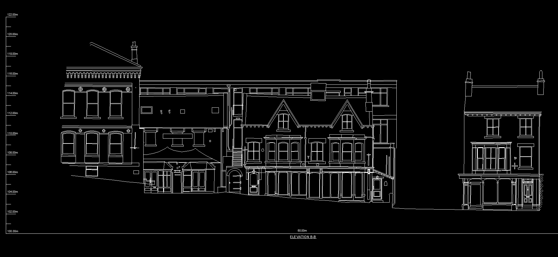
- Elevations - usually external but can also be internal for interior design. These will show architectural design, fenestration, quoins, openings, change in material etc.
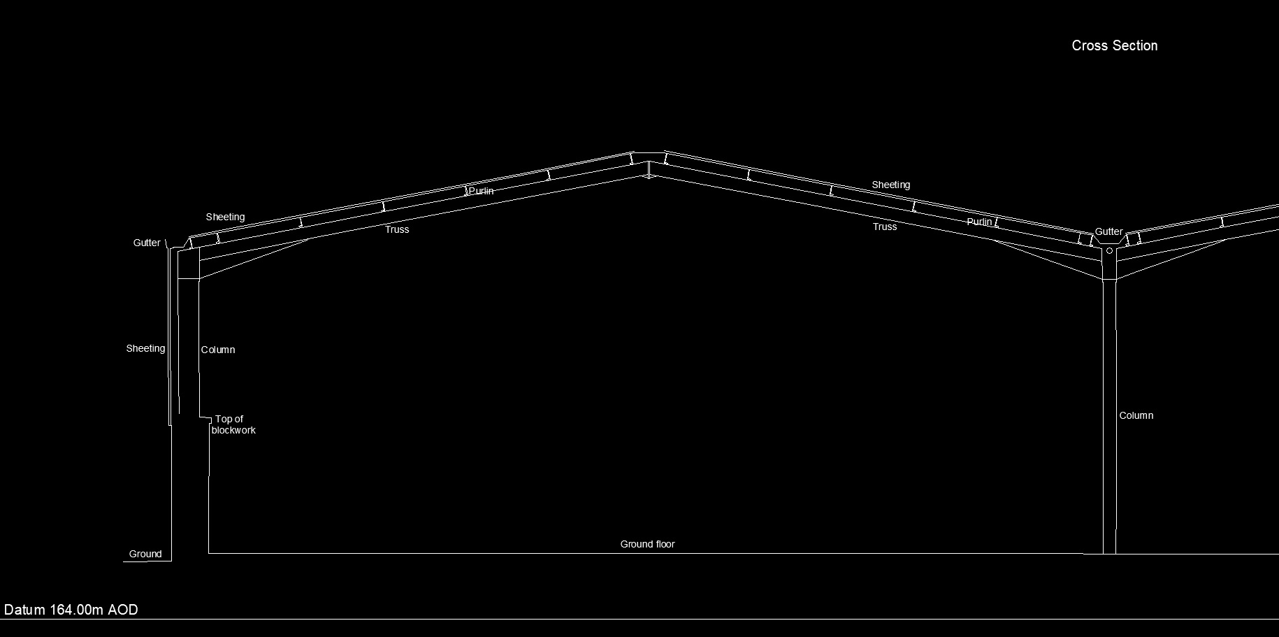
- Sections – The cloud can be manipulated to draw cross and long sections thought the building at areas of interest. These will show floor and ceiling layouts, stairs, windows etc
- Roof plans – Subject to line of sight from surrounding ground level or suitable access onto the roof, we can create a birds eye view of the roof layout, showing ridges, hips, valleys, gutters etc with levels. In some cases, the deployment of a drone to capture out of sight areas can be used.